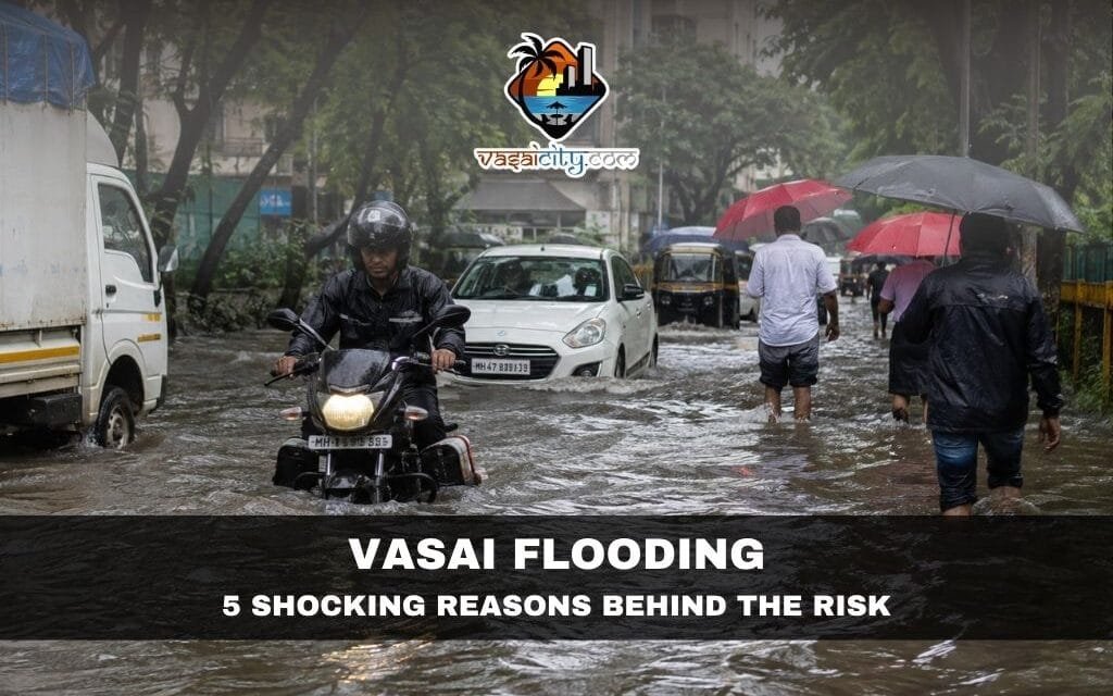
Vasai flooding is no longer simply a seasonal inconvenience for residents. Every monsoon, intense rainfall brings waterlogging, disrupted transport, flooded homes and serious questions about whether the city is prepared for increasingly extreme weather.
The frightening images of floods and landslides in other parts of South Asia should be a warning for every coastal and rapidly urbanising city. For Vasai-Virar, the message is particularly important: natural landscapes that once helped absorb and channel excess rainwater cannot be treated merely as vacant land waiting for development.
The region has hills, forests, wetlands, mangroves, creeks, water bodies and salt pans. Together, these natural systems act as buffers against heavy rainfall and flooding. When they disappear or are obstructed, rainwater has fewer places to go.
That makes Vasai flooding not just a question of rainfall, but also a question of land use, drainage, environmental protection and urban planning.
Table of Contents
Vasai Flooding Has More Than One Cause
The reasons behind Vasai flooding are complex. Heavy rainfall is certainly an immediate trigger, but the consequences can become much worse when natural drainage routes are blocked and built-up areas expand rapidly.
An official Vasai-Virar City Development Plan had already identified several weaknesses in the region’s stormwater system, including inadequate culvert capacity, obstructions in drains and the effect of high tides pushing water back through channels that ultimately discharge into creeks.
This means the city’s flooding problem is not entirely new.
What has changed is the scale and intensity of urban development, combined with growing concerns about extreme rainfall.
1. Rapid Construction Is Increasing Vasai Flooding Risk
One of the biggest concerns behind Vasai flooding is the rapid conversion of open land into concrete surfaces.
Buildings, roads, parking areas and paved surfaces prevent rainwater from naturally soaking into the ground. Instead, large quantities of water run quickly across the surface and enter drains, nallas and other waterways.
When rainfall arrives faster than these systems can carry the water away, roads and neighbourhoods can quickly become waterlogged.
This is particularly concerning when development takes place without sufficient attention to the capacity of existing drainage infrastructure.
Urban growth itself is not necessarily the problem. The real issue is whether infrastructure and environmental safeguards grow at the same pace.
2. Natural Waterways Must Not Become Casualties of Development
The landscape around Vasai-Virar has historically provided natural routes for rainwater.
Streams and nallas originating around the eastern hills move water towards the western coastal areas. Wetlands, low-lying areas and other natural depressions can temporarily hold excess water before it moves onward.
When these pathways are filled, narrowed, diverted or obstructed, water does not disappear.
It simply finds another route — often through roads, residential colonies, shops and ground-floor homes.
Previous assessments of Vasai-Virar’s flooding problems have also highlighted blocked waterways, inadequate structures and waste accumulation as factors affecting drainage capacity.
Protecting these natural drainage systems should therefore be considered part of flood prevention, not merely environmental conservation.
3. Wetlands, Mangroves and Salt Pans Are Natural Flood Buffers
For a coastal region, wetlands and mangroves are valuable infrastructure — even though they are not made of concrete.
They absorb and temporarily store water, slow down runoff and provide natural protection along vulnerable coastal areas.
The destruction or reclamation of such areas can therefore increase the pressure on man-made drainage networks.
Recent concerns raised by environmental groups in the Vasai-Virar region have specifically focused on alleged destruction and reclamation of wetlands, mangroves and low-lying areas in connection with recurring flooding. These are allegations and should be investigated by the appropriate authorities rather than treated as established findings without evidence.
The broader lesson, however, is clear: natural flood buffers should be mapped, protected and incorporated into the city’s flood-management strategy.
4. Extreme Rainfall Can Overwhelm the City Within Hours
Another major factor behind Vasai flooding is the changing nature of rainfall.
The problem is not simply how much rain falls during an entire monsoon season. The timing and intensity of rainfall matter enormously.
If a large volume of rain falls within a few hours, drainage systems have to handle that water almost immediately.
A city designed around historical rainfall patterns can struggle when rainfall arrives in short, exceptionally intense bursts.
The Maharashtra State Disaster Management Authority’s 2026 monsoon preparedness review specifically included urban flooding, flood-prone areas, transport readiness and emergency coordination among the issues requiring attention across the state.
For Vasai-Virar, this means flood planning needs to account for extreme rainfall events rather than relying only on average monsoon conditions.
5. Coastal Geography Makes Vasai Flooding More Complicated
Vasai’s location adds another layer to the problem.
The region sits between the eastern hills and the Arabian Sea, with several rivers, creeks and drainage channels carrying water towards the coast.
During heavy rainfall, enormous volumes of water can move downstream quickly.
At the same time, high tides can slow the outward movement of water through coastal drainage channels. The older city development assessment specifically identified this backwater effect as a contributor to flooding in low-lying areas.
This is why simply widening a few drains may not solve Vasai flooding.
The city needs a coordinated system that considers rainfall, topography, rivers, creeks, tides, drainage capacity and land-use patterns together.
Why Infrastructure Planning Matters
The recurring pattern of Vasai flooding raises an uncomfortable question: can the city’s infrastructure keep pace with its physical growth?
More homes mean more roads. More roads mean more paved surfaces. More construction means greater pressure on water, sewage and stormwater systems.
If these systems are not upgraded simultaneously, the consequences eventually appear during extreme weather.
The issue is not about opposing development. Vasai-Virar needs housing, employment, transport and infrastructure.
But development has to be planned around the natural characteristics of the region rather than forcing nature to accommodate every project.
A city cannot remove its natural drainage system and then expect concrete drains alone to perform the same job indefinitely.
Is Anything Being Done About Vasai Flooding?
Authorities do undertake monsoon preparedness and emergency-response measures.
At the state level, Maharashtra’s 2026 monsoon preparedness review brought together municipal bodies, district administrations, emergency agencies, railways and other departments to coordinate responses to flooding and other monsoon-related emergencies.
Vasai-Virar has also seen infrastructure initiatives aimed at improving resilience. For example, Western Railway has announced plans to raise railway tracks in the region by 400 mm as part of measures intended to reduce the impact of monsoon flooding on rail operations.
Such measures are important, but Vasai flooding cannot be solved through emergency response alone.
Pumps, rescue teams and temporary traffic measures are necessary when flooding occurs. They do not, however, address why the same locations repeatedly flood.
That requires long-term planning.
What Vasai Needs Before the Next Major Flood
The first priority should be a comprehensive mapping of the city’s natural drainage network.
Every major stream, creek, wetland, mangrove belt, water body, floodplain and low-lying retention area should be identified and incorporated into development planning.
Second, stormwater drains and culverts need to be assessed against present-day rainfall conditions rather than outdated assumptions.
Third, natural drainage channels must be kept free from obstruction and illegal dumping.
Fourth, new development should be evaluated for its impact on surrounding drainage patterns. A project that solves its own water problem but pushes excess runoff into a neighbouring settlement cannot be considered adequate planning.
Finally, flood management should be treated as a year-round urban-planning responsibility rather than a crisis-management exercise that begins when the monsoon arrives.
Protect Nature Before We Have to Pay for Its Destruction
The central lesson from recurring Vasai flooding is simple: natural infrastructure has value.
A wetland may look like empty land. A mangrove belt may appear undeveloped. A seasonal stream may seem insignificant during the dry months.
But during an extreme rainfall event, these areas can become critical components of the city’s flood defence system.
Once they are destroyed, replacing their ecological function with concrete infrastructure can be extremely expensive — and sometimes impossible.
Vasai-Virar is a growing urban region, but growth should not come at the cost of the natural systems that make the region safer.
The question is therefore not whether Vasai should develop.
It is whether Vasai can develop without destroying the natural infrastructure it will need to survive the next extreme monsoon.
If the city waits until another devastating flood exposes every weakness, the cost will be paid by residents.
Protecting hills, forests, wetlands, mangroves, salt pans, waterways and water bodies today may be one of the most effective investments Vasai-Virar can make for tomorrow.