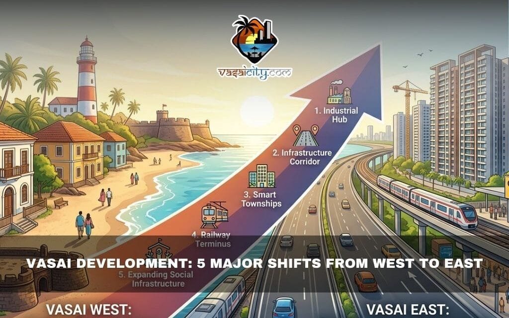
Vasai Development has undergone a dramatic transformation over the last two centuries, shifting the town’s growth from its historic western coastline to the rapidly expanding eastern suburbs. What was once a region oriented toward ports and maritime trade slowly evolved into a railway-driven suburban hub connected to nearby cities.
Today, the changing landscape of Vasai Development reflects how infrastructure, transport routes, and economic priorities reshaped the entire region.
Table of Contents
Early Vasai Development Focused on the Western Coast
For centuries, Vasai Development was closely tied to the Arabian Sea. The western side of the region served as the main gateway for trade, travel, and communication with other parts of India and the world.
Ports located near the historic settlements of Vasai, Sopara, and Arnala were the main entry and exit points for merchants, travelers, and local residents. The sea routes connected the region to north India and the Deccan through maritime trade.
As a result, the western coastline became the focal point of Vasai Development during earlier centuries.
Historic landmarks such as Vasai Fort and Arnala Fort were strategically constructed along the coast to protect trade routes and the region’s political interests.
Administrative structures were also located within Vasai Fort. The first municipal systems and local governance institutions emerged within the fort’s premises, reinforcing the western region’s importance.
Meanwhile, the eastern side remained largely untouched.
Why Eastern Vasai Remained Undeveloped for Centuries
The eastern region of Vasai looked very different from the bustling ports in the west.
Large stretches of wetlands, dense forests, mountain ranges, and scattered villages dominated the landscape. The terrain was difficult to develop and had limited transportation access.
Because of this, Vasai Development largely ignored the eastern side for many years.
Population remained sparse, and most economic activity continued near the coastal areas. The east was mainly agricultural land filled with paddy fields, coconut plantations, and rural settlements.
However, this would soon change with the arrival of modern transportation.
Railway Expansion That Transformed Vasai Development
A turning point in Vasai Development arrived in the 19th century when the Bombay, Baroda and Central India Railway Company built railway lines across the region.
The railway track passed through villages such as Naigaum, Umele, Manickpur, Achole, Nalla Sopara, Virar, and Vaitarna.
With this expansion, several important railway stations emerged on the eastern side, including:
These railway connections linked Vasai directly with the rapidly growing city of Mumbai, which was then the capital of the Bombay Presidency and a major industrial and port center.
This connectivity dramatically reshaped Vasai Development.
Eastern settlements began transforming into small townships as people moved closer to railway stations for employment and travel convenience.
Gradually, rail transport replaced traditional waterways.
As railway traffic increased, the once-busy coastal ports fell into decline. Trade through sea routes slowed down, maritime commerce weakened, and the town stopped relying on western ports.
For the first time, Vasai Development started looking toward the east.
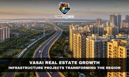
Highway Infrastructure Accelerated Vasai Development
Another milestone in Vasai Development came in 1972 with the construction of the Bombay–Baroda Highway.
The highway ran along the foothills of eastern Vasai and significantly improved road connectivity.
This infrastructure boosted:
- Industrial activity
- Commercial growth
- Residential development
Factories, warehouses, and housing projects began appearing across eastern Vasai, further strengthening the area’s economic importance.
The transformation continued in 1984 when a new railway line connected Vasai to Kopar. This development turned Vasai Road into a railway junction, increasing passenger movement and regional connectivity.
From that point onward, Vasai Development accelerated rapidly.
Over time, the expanding population and urban infrastructure led to the creation of the Vasai-Virar Municipal Corporation, formally recognizing the region as a major urban center.
Western Vasai Preserved Its Traditional Charm
While the east experienced rapid urbanization, the western side retained much of its original rural character.
Villages along the coast continued their traditional lifestyle, surrounded by narrow country roads, coconut plantations, and rice fields.
Because of its peaceful environment and relaxed lifestyle, many people affectionately referred to western Vasai as “Mini Goa.”
Old-style homes, fishing communities, and agricultural land remained part of daily life.
However, residents of western Vasai increasingly depended on the east for:
- Railway transport
- Markets and commerce
- Jobs and commuting
Despite being historically important, the western region gradually became quieter compared to the expanding eastern suburbs.
You can also read more about the history of the fort region here: https://www.vasaicity.com/discover-the-city/bassein-fort.html
RoRo Ferry Could Shape the Next Phase of Vasai Development
Recently, Vasai Development may be entering another new phase.
The introduction of a RoRo ferry service connecting Vasai Fort with Bhayandar has revived interest in water-based transport.
If expanded further, this waterway could potentially connect Vasai with cities such as:
- Thane
- Kalyan
- Mumbai
- Palghar
- Gujarat
If such connectivity becomes reality, it could revive maritime activity and shift attention back toward the western coast.
Ports, passenger transport, and commercial trade may once again flourish along the shoreline.
In a way, history could come full circle – and Vasai Development might start looking westward again.
Inputs by Biju Cherian
This article is based on the author’s research and perspectives. The publisher claims no responsibility for inaccuracies. Views expressed are the contributor’s alone. Institutions mentioned are not endorsed unless specified.


